Allalinhorn via Hohlaubgrat
To get to the Britanniahütte via the glacier trail from Mattmark, you have to cross two glaciers and a field of wild beasts. The beasts in question are cows. They are pictured here as small dots.
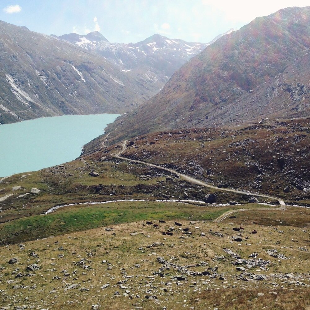
No ordinary cows!
Scoff if you will at their peaceful appearance. I was there, man, and these cows were crazy. They were running up and down their field as a group, bucking as though trying to get an invisible rider off their backs. Some were clashing horns with each other while others ran around. As Tanya and I approached the fence, three of them turned, looked us in the eyes, then charged towards us, sending us scattering back down the slope. I write 'fence', but that is overdoing it a bit - the cows were behind a single piece of flimsy electric-fence wire that wasn't running. After observing the wild behaviour of the cows, we retreated a hundred metres to consider our next move. We eventually detoured around the field by climbing a steep and rocky gully. By the time we emerged back onto the walking track, the cows were far below, and for all the world they looked like normal, peaceful cows. That is when I took the photo. Those bastards.
Apart from the advantage of preventing us from being gored, the annoying detour also had the plus that it took us past the first edelweiss either Tanya or I have ever seen in the wild. So, swings and roundabouts.
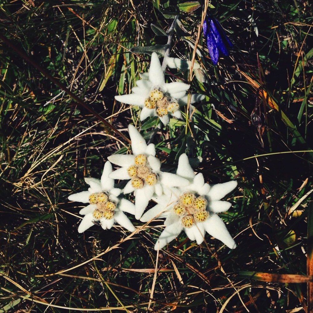
Edelweiss!
The Britanniahütte is at 3030 m, on the east side of a ridge that separates it from the ski resort of Saas-Fee. There are various options to get there but the most spectacular is to walk the glacier trail, which starts at the Mattmark dam. Being in Switzerland, there are good public transport connections to the dam from Visp via Saas-Almagell (which I always hear as "Saas-aw-mah-gawd"). The trail climbs steeply to about 2800 m and then safely and easily crosses both the Allalingletscher and the Hohlaubgletscher, delivering you to the hut in about four hours if you don't divert for wild cows. We had a lovely encounter with a family of bouquetin (ibex)!

First view of the Allalingletscher and Hohlaubgletscher.


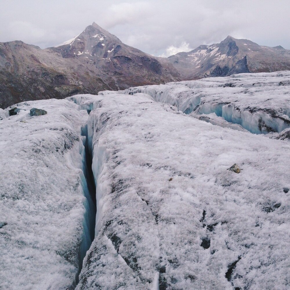
Crevasses on the Hohlaubgletscher.

A very well marked track.
The view from the hut is spectacular and the people there were super friendly. The food was great, and they had the best coffee I've had in a while. We were sorted into rooms by climb, because the wake-up time for each climb is different.
The Alallingletscher; Mattmark dam is at the head of the lake.
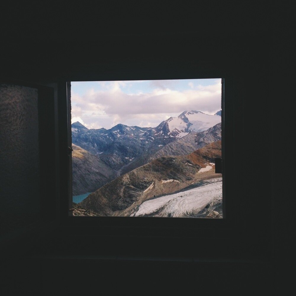
This is the view from the toilet window.
The next morning Tanya and I were going to climb Allalinhorn (4027 m) by the Hohlaubgrat ridge. This is a classic route that climbs easily above the hut, then gradually steepens on a snow ridge until a rock-step just before the summit. The crux of the climb is passing this step (30 m, II+, bolted), and the fact there is pitched climbing in it earns the route a grade of AD-. Our wake up time was 4h45. When we got to the glacier at 5h30 it was foggy, and we hesitated before heading onto the ice with bad visibility. Luckily it cleared as we roped up and after a short wait we were on our way. By dawn we were high on the Hohlaubgletscher and about the join the ridge. Allalinhorn changed colours as the sun rose; first it was icy blue, then pink and orange, and finally piercing white.

Dawn over the Hohlaugletscher.

Hohlaubgrat ridge and Allalinhorn with the dawn light.
In the photo above you can see almost the whole route. After the glacier you join the snow ridge, which is very easy at first but gradually gets steeper. The last few metres to the rock step are on a 40 degree slope. At the rock bar, we switched to pitched climbing. The first pitch was easy rocks with bolts and a tremendous sense of exposure, followed by a very short section of snow and ice - unnerving for me, but it went easily and I belayed Tanya up on a good anchor. The second pitch was easy climbing with bolts where you need them. At the same time that I was leading up, another group of climbers were abseiling down from above and more were coming up from below, so it was quite an operation just to get past everyone. At one point I found myself standing next to a climber about to abseil. He had neither a descender nor any fear. He was about to rap on a single carabiner with the rope wrapped through it, and for backup he had a prussick that was so loose as to be absolutely useless. I tried to tell him he should at least make his prussick better, but we had no common language and he didn't have time for me. Thank goodness his system actually worked and he got safely down.
I don't have any pictures of the climb between the glacier and the summit, because I had my hands and mind full with the climbing itself. You will have to believe me that the scenery and climbing were both spectacular. From the top of the rocky bar we walked easily to the summit. For me and Tanya this was our second 4000 m peak and our most technical mountain route, so we drank in the view with giant grins.

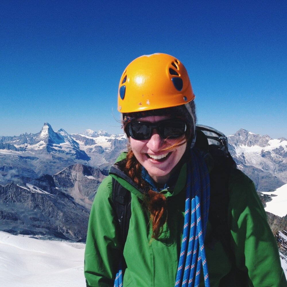
Matterhorn, Dent d'Hérens, Mt Blanc, Dent Blanche. Climbers on the Allalinhorn normal route.

Rimpfischhorn.

Climbers a few metres below the summit.
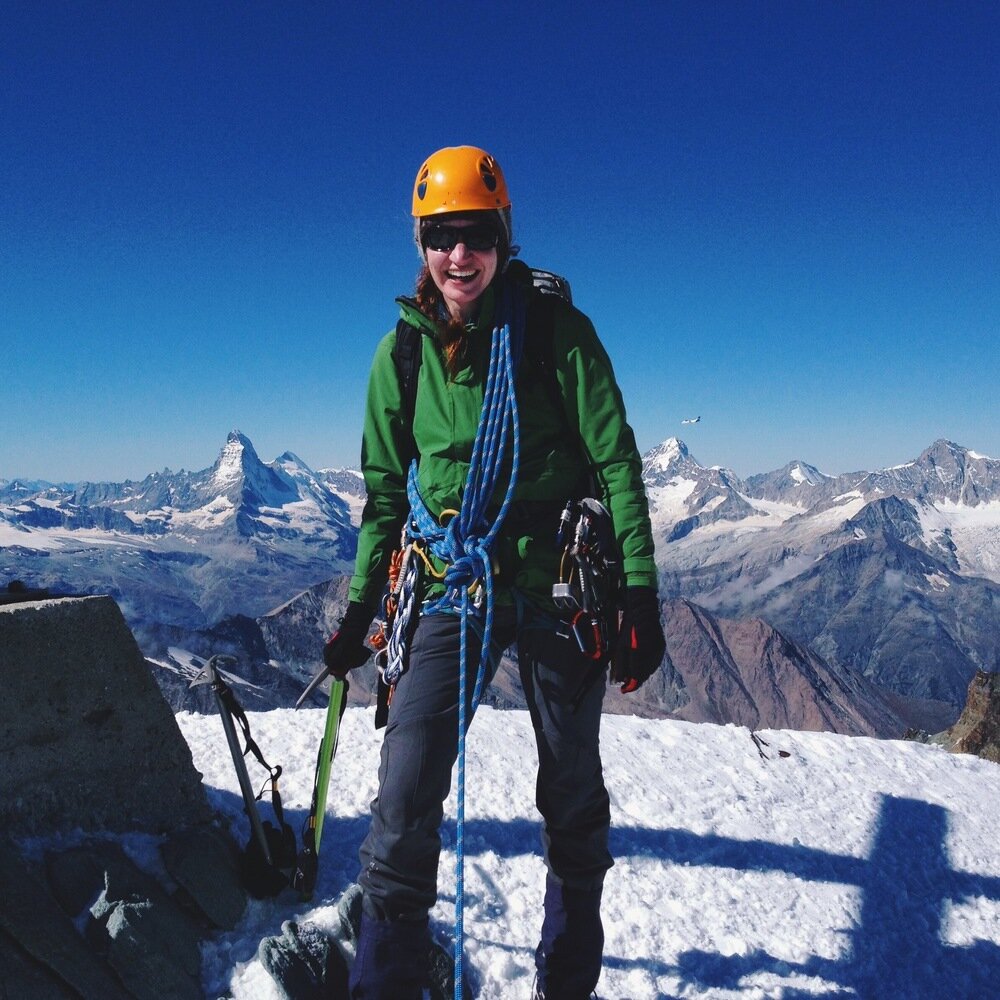
Tanya on the summit!
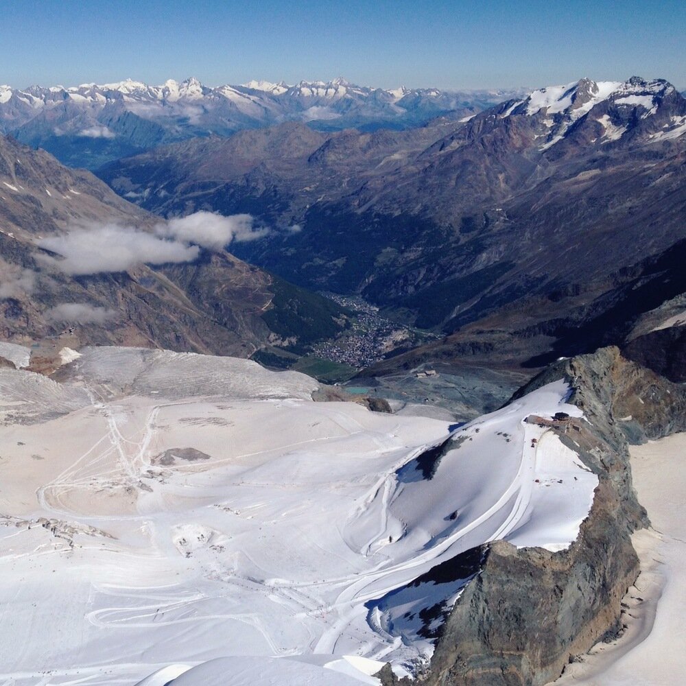
Saas-Fee and its ski resort, from the summit. The building on the ridge is Mittelallalin station, and it is at 3457 m.
We descended via the normal route by heading down the gentle south face and around to the Saas-Fee ski area. The normal route of Allalinhorn is a very easy way to bag a 4000 m peak, so there were plenty of people on it. Although all the guides say to be very careful of crevasses, there were people on this route with no glacier gear whatsoever. Back in the ski resort it was busy with skiers and snowboarders using the year-round snow cover to practice during summer. We took the easy option and caught the metro-alpin down to Saas-Fee. This had two big advantages: firstly, it delivered us to a celebratory beer and rösti extra fast, and secondly, we didn't have to cross those crazy cows again.

Allalinhorn and Hohlaubgrat ridge, with its rock step just below the summit.

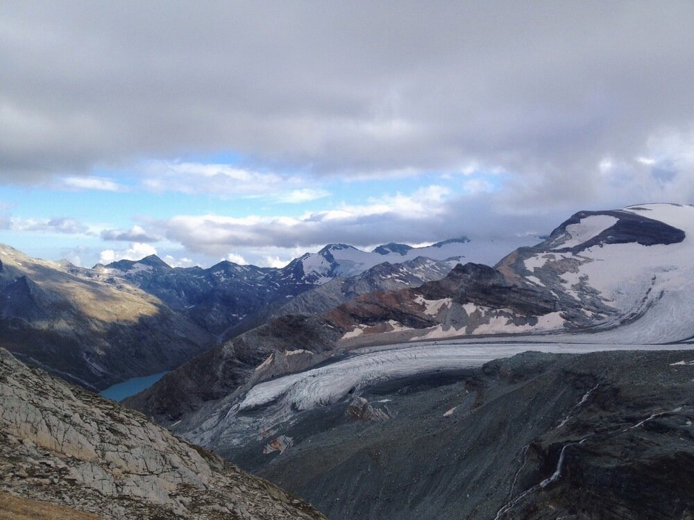
Glaciers of Saas-Fee.