Trifthütte
The Triftgletscher lies a couple of valleys above Meiringen in the Swiss canton of Bern. To get there, like anywhere in Switzerland, you can take public transport and then walk. You get the train to Meiringen, catch a tiny one-carriage train to Innertkirchen, jump on a post bus to Triftbahn, and then you have the option to either catch a cable car and walk, or just walk from the road. Andy, Karl, Tanya and I took the second option and weaved our way on foot through gorgeous fields, past the end of the cable car, and to the Windegghütte at 1887 m. From there a short scramble through rocks took us towards Triftbrücke and our first glimpse of the Trift glacier itself.

The Triftgletscher.

Triftgletscher over the newly formed Triftsee.
Looking at this glacier on historic maps I was shocked and greatly saddened to see how much it has melted recently. Look at the photo above, and then consider that as recently as the year 2000 no lake existed — the glacial itself covered the entire valley floor. (The first Swiss map to show the lake is from 2007). The photo is taken from a new bridge which is an impressive distance above the river below, and maps from the 1950s show ice well above the bridge level. It is upsetting to see the effects of climate change happening so clearly and so quickly.

The view down from the bridge at Triftbrücke.
We kept walking. After the bridge the track changed from a "mountain" path to an "alpine" path and as if to prove the point the track immediately presented several ladders to climb down and then a couple of small river crossings. We climbed steeply up the east side of the valley, making the lake smaller and smaller as it fell away below us.

Ladders!


It was rhododendron season and the bright flowers were everywhere.


Gorgeous hiking country.

Monster rock!

A track marker and the ever-present rhodos.


The track sidled around the slope and was quite steep at times, and there were chains strung between handy rocks that we could hold onto as an extra bit of assurance. As we got higher, the icy plains above the glacier snout opened up, and we could see more and more of the surrounding snowy peaks.

Tanya and Karl hiking above the Triftsee (the bridge is way back in the narrow section of the valley, next to the lake).


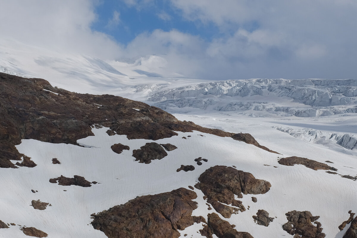
Now on level with the Triftgletscher.

After a good day's walk, we arrived at the Trifthütte at 2520 m. We were very warmly welcomed, and the scenery was spectacular: clouds played around the tops and occasionally the sound of ice moving in the glacier would reach us at the hut.

At Trifthütte.

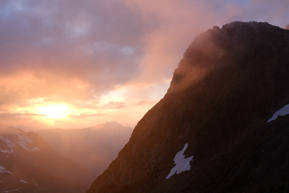
That evening there was one of the most spectacular sunsets I've seen in the mountains.

Sunset from Trifthütte.

The next day just involved walking down again! We explored the edge of the ice field, and then turned for the descent, leaving behind us the melting glacier and its rhododendrons.


Morning at Trifthütte.

Look carefully here to see Tanya in silhouette.
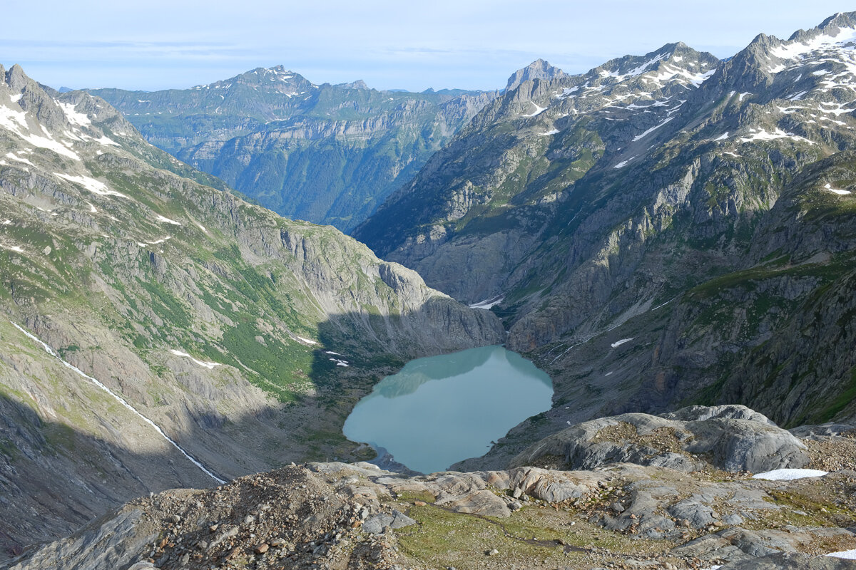
Triftsee from on high.

Tanya and Andy exploring the moraine.


Rhododendrons on the descent.